Active Transportation
Programs and Activities
Bike Exchange |
|
Free Event! All Ages Welcome Date | Saturday, June 14, 2025 Time | 10:0am to 11:00am Location | Dymond Community Complex Garage How it Works
Helmets | Please make sure you bring your own helmet if you have one. Parking | Please park at the rear of the building, off of Raymond Street. Do not block the Fire Hall doors. For more information on this event, please contact: |
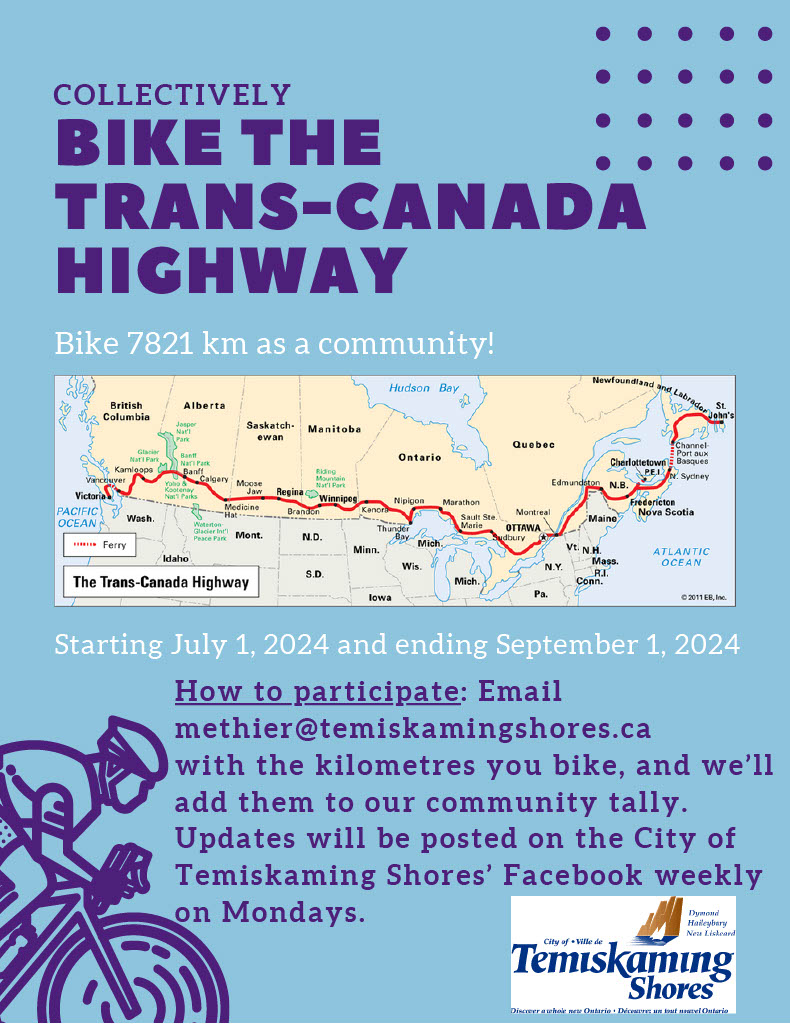
Bike the Trans-Canada Highway |
|
Congratulations! We've made it! We have arrived at St. John's. NL. |
South Temiskaming Active Travel Organization (STATO Trail)
Open for the Season | May 27, 2025City staff have completed spring maintenance on the STATO Trail including sweeping the trail and installing the yellow bollards.
Please continue to use caution while traveling on the STATO trail and be mindful of people travelling using different modes of transportation.
About |

In 2004, The South Temiskaming Active Travel Organization (STATO) was formed as a result of community members’ interest in promotion and development of an active participative transportation routes through the City of Temiskaming Shores highlighting the waterfront. In 2005, The City of Temiskaming Shores approved the process of establishing a multi-use trail/linear park and in 2006, a by-law to establish a linear park/Active Travel maintenance program for the Corporation of the City of Temiskaming Shores was adopted. Council determined that a Community Health and Wellness/Healthy Community Design would be incorporated into the City's new Official Plan Process. At that point, STATO initiated a community-wide citizens’ engagement process and we focused our energies from 2007 to 2015 on fundraising, including a yearly fashion show and ice fishing derby, walk-run-bike events, hockey and golf tournaments, numerous sales, galas, musical events, amazing races, auctions, private donations, Government funding, and more. In 2008, they began the construction of 20 kilometers of paved bike path, complete with bollards, rumble strips, lines and stamping. They continue to work towards the vision of linking the trail to schools, fitness facilities, and different parts of town to make it more accessible. To date, almost 21.4km has been completed and the surfaced trail is accessible to all residents and visitors, is wheelchair accessible and provides for recreational opportunities to people of all walks of life. Residents of and visitors to Temiskaming Shores can enjoy the benefits of walking, strolling, cycling, jogging, roller blading and other non-motorized activities throughout the City on a safe route.
Through the Bicycle Friendly Committee, STATO continues to increase awareness and promote physical activity for a healthy community, as well as economic growth and recreation development. You can follow ongoing activities on the Facebook page.   |
Cycling in Temiskaming Shores
The City of Temiskaming Shores is on the move! Not only is the STATO trail available to use from Dymond to Haileybury but a plethora of other options are available to stay active. Route maps have been created for cycling options both in the city and in the surrounding area. The booklet can be downloaded at the link below. Individual routes will be split and provided at a later date.
South Temiskaming Bicycle Routes Map
Counting Data
The City of Temiskaming Shores has three pedestrian counters which are used to collect data on the number of people using locals trails and pathways. Data is collected approximately every 60 days and will be updated here periodically.
Active Transportation Plan
About |
| In 2021 the City of Temiskaming Shores created its first Active Transportation Plan.
The purpose of the plan is to:
View or print a copy of the below Active Transportation Plan |
November 2021 - Public Information Session |
|
The City's consultant, WSP Canada, conducted a virtual public information session on November 4, 2021. That session is available to watch on the City's Youtube page at the following link: You can also check out the interactive Miro Board and place comments around the maps. Let us know what you think at this link: |
Frequently Asked Questions (FAQ)
What is the Active Transportation Plan (ATP)? |
|
The ATP is being prepared to identify and develop an effective approach to promoting active transportation use across all parts of the City. Active Transportation is broadly defined as all forms of transportation that are powered directly by you including: walking, running, cycling or rolling. Foundational to the ATP is a prescribed network of integrated on-road and off-road (trail) facilities which enable active transportation users to travel between key destinations safely, conveniently and seamlessly. Additionally, the ATP will identify a suite of educational and promotional programs that increase active transportation’s profile and cultural presence within the community. Given the competitiveness of existing municipal finances, the ATP will also feature high-level costing and scheduling for all recommendations to guarantee their cost-effective and feasible delivery. With a focus on applying a context sensitive approach, the ATP will build upon the guidance of the existing Recreation Master Plan (RMP). This includes the consideration of the plan’s recommended expansions of the STATO trail system, which connect to key travel destinations still underserviced by the current trails and active transportation network. Similarly, the ATP will also evaluate the RMP’s prescribed trail design guidelines in standards. The ATP will evaluate and confirm the RMP’s defined trail hierarchy, comprised of the STATO Trail, Greenway and Community Trail components. Given this context, the ATP will focus on reviewing the feasibility of these existing trail recommendations rather than replacing them. Greater focus will also be placed on identifying ways to improve their access through new on-road and connecting off-road links. |
Who is this active transportation plan for? |
| The City of Temiskaming Shore’s Active Transportation Plan is a project for everyone. By coming together to create a vision of the City’s active transportation network, we are developing a blueprint to effectively identify and support opportunities to be active, outdoors and travel without the use of a personal automobile. This benefits everyone in our communities by promoting healthier lifestyles, safer traffic environments, less strain on local roadways, improved local air quality and greater commerce through new tourist attractions |
What can improved active transportation facilities provide? |
| Through the Active Transportation Plan, the City of Temiskaming Shores seeks to identify an approach that effectively leverages active transportation to both enhance mobility and provide additional opportunities for recreation and exercise. An improved active transportation system encourages healthier active lifestyles by offering new ways to access and exercise within the City’s rich natural landscape. It also facilitates new ways to travel both within and between the City’s anchoring communities of New Liskeard, Haileybury and Dymond - fostering greater social cohesion. These benefits not only extend to residents but visitors alike, making improved active transportation equally an asset to the City’s established tourism sector. |


 Subscribe to this page